Simi Valley Mining GCCS Expansion Design and Construction Quality Assurance
Client
City of Simi Valley
Brand
Market
Service
Role
Subconsultant
Challenge
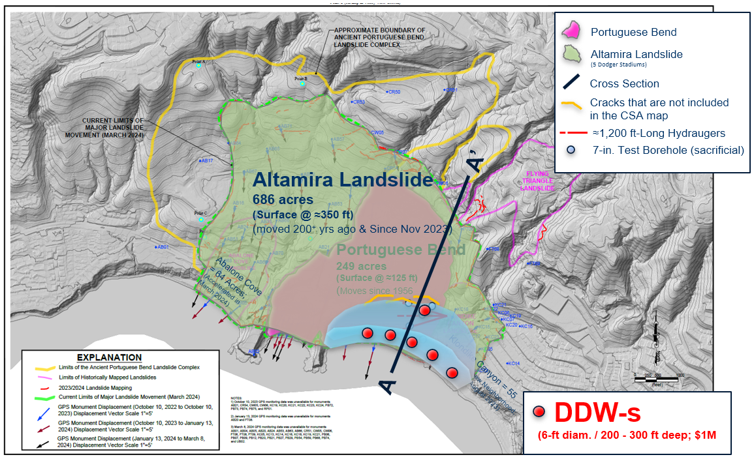
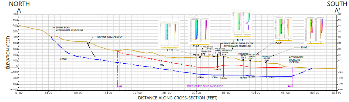
The Portuguese Bend landslide is one of several historically active and dormant landslides that now form the Altamira Landslide. These landslides are present within the ancient Altamira Complex that has been mapped by various individuals and agencies in the past. The Altamira Landslide did not move until late 2023. Recent investigations indicate that movement of the Altamira Landslide is significantly deeper than the Portuguese Bend landslide and extends below the active and dormant landslides in the area. Locally, it involves at least two separate slip surfaces moving in different directions.
The Portuguese Bend and other neighboring landslides have been studied since at least 1956. A singular attempt by the US Army Corps of Engineers to mitigate the landslide failed. In 2023, after over 70 years of study by others, the Portuguese Bend landslide mitigation measure was selected and accepted by the stakeholders, designed, approved, and funded. The approved design involved installation, servicing, and monitoring of five groups of artesian-pressure-relieving directionally-drilled wells, approximately 1,400 feet, referred to as “hydrauger batteries.”
Solutions
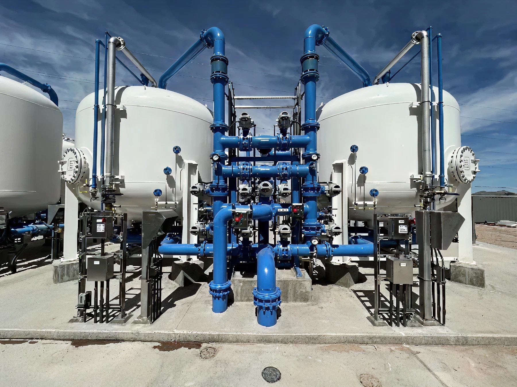
Shortly before hydrauger installation commenced, however, the Altamira Landslide movement started. Following the disaster designation of the entire Altamira Landslide area, the mitigation of the Portuguese Bend landslide was put on hold while emergency mitigation measures were developed and implemented. They included tentative installation of 11 deep dewatering wells up to 340 feet deep along the toe of the Altamira Landslide.
Results
In-construction monitoring showed a rapid decrease in groundwater pore pressures at various levels within the landslide. GPS surveys of monuments confirmed that dewatering significantly reduced movement of the Altamira Landslide, including local cessation of instability.
… the City was just informed that we are a recipient of a $23.3 million grant from FEMA for the Portuguese Bend Landslide Project. …we made many last-minute requests, all of which you accommodated. The information you and your team provided was critical to the success of the grant application… we could not have done it without you and we are very grateful.”
— Ramzi Awwad / City of RPV Director of Public Works